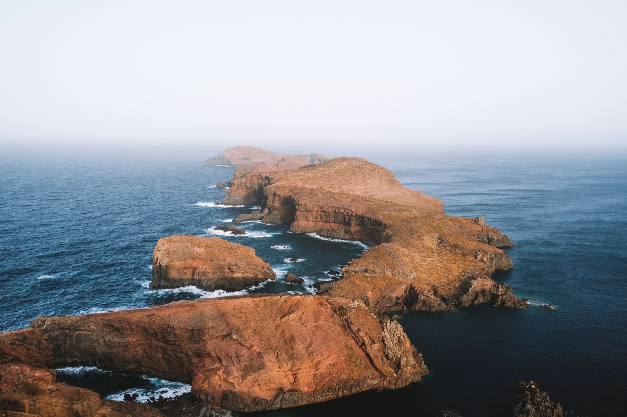
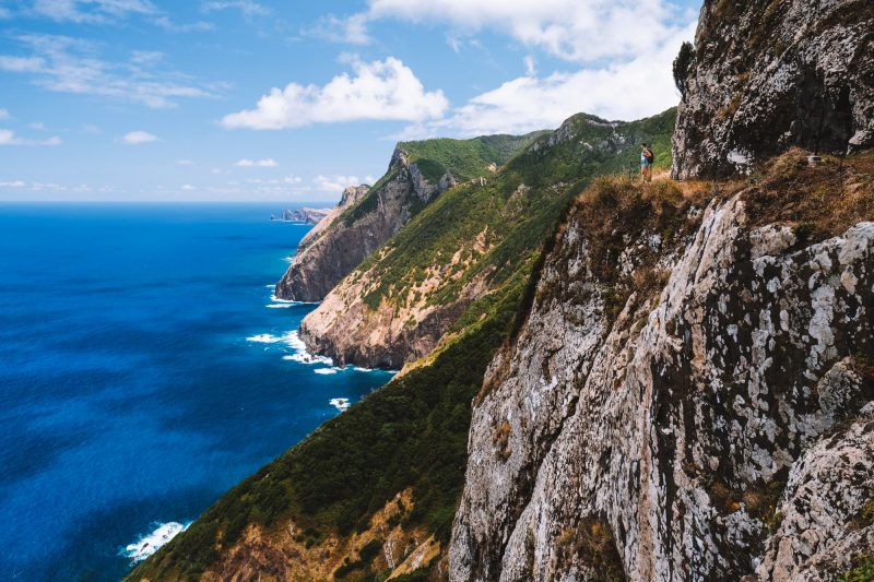
In the east of Madeira, you will find Ponta de São Lourenço, a narrow 6-kilometer-long (3.7 miles) peninsula with a completely different landscape than the rest of Madeira. On the map, this area looks like a tail hanging from the island. Ponta de São Lourenço is characterized by a dry hilly landscape, and there were several volcanoes in this area long ago. The landscape resembles a lunar landscape. At first glance, it may seem like not much grows here, but there are actually 138 different plant species, with 31 of them found exclusively in Madeira. Are you getting excited? The PR8 Ponta de São Lourenço hike takes you through this unique part of Madeira. Continue reading for our tips!
The PR8 Ponta de São Lourenço hike in brief
Distance: 7 kilometers (4.3 miles)
Duration: 2 to 3 hours
Elevation difference: 470 meters (1,542 feet)
Difficulty: Easy
What does the PR8 look like?
The PR8 Ponta de São Lourenço hike is not a difficult walk. You will traverse a hilly path, but there are no steep climbs or descents, except for the climb to the viewpoint at the end. There are few cliffs, and where they do exist, there are fences. Along the hike, you will encounter several beautiful viewpoints. Make sure to stop at Miradouro de São Lourenço and Ponta do Castelo as these viewpoints are both absolutely beautiful!


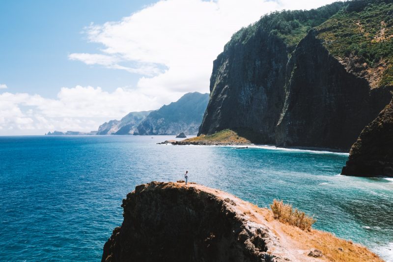
After walking about 2.5 kilometers (1.55 miles), you will reach a junction (see photo of sign below) where you can go left or right. Both routes will lead you to the same viewpoint, so it doesn’t matter which direction you choose. The route to the left is an easier and less eventful path. The route to the right is a bit more hilly, and you will pass by a tiny, charming beach. It’s refreshing to take a dip here if the temperatures allow. Eventually, the paths merge again, and there you will find a restaurant where you can have some food and drinks. After this restaurant, you begin the climb to the final viewpoint, Miradouro Ponta do Furado. This last section is relatively steep, with some high steps that can be slippery after rain. Once you reach the top, the view is magnificent. You can gaze miles into the ocean, where the rugged cliffs rise straight out of the water. On clear days, you may even catch a glimpse of the neighboring island of Porto Santo.

There is a sign at the beginning of the climb stating that walking to this viewpoint is prohibited, but everyone ignores it and walks to the viewpoint. Appropriately, the “prohibited access” sign was lying on the ground when we were there. After this viewpoint, you begin the return journey. You walk back along the same path, but you can also choose to take the other direction at the junction on the way back.

Extra tip: Ponta do Rosto viewpoint
The impressive Ponta do Rosto viewpoint is located a 5-minute drive from the starting point of PR8, and it is too beautiful to miss while you’re in the area. It’s not on the PR8 route, but it’s easily accessible by car. If you’re an early bird, we recommend watching the sunrise from this viewpoint before starting the hike. The sunrise here is incredibly beautiful! You can drive to this viewpoint, so no hiking is required.

How to get to PR8 Ponta de São Lourenço hike?
By rental car: By far the easiest way to get to the starting point of this hike is by rental car. It’s approximately a 30-kilometer drive from Funchal, and it takes about 30 to 40 minutes. There are plenty of parking spaces where you can park your car for free, and this is the exact location of the parking lot.
With a tour: If you don’t have a rental car, you can consider this tour to do the hike. You will hike with a small group and a guide who will provide information about the island and the flora and fauna you encounter. You will be picked up from your hotel and dropped off after the hike.
By public transportation: Another option to reach the starting point of this hike is by public transportation. Bus line 113 operated by SAM is the only bus that goes to Baia d’Abra, the starting point of the hike. Check the current bus schedule in advance.

