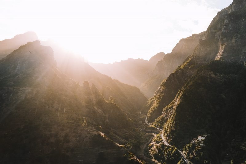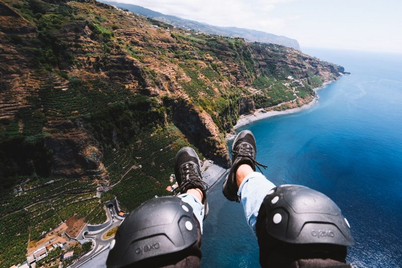
Madeira is known for the fantastic hikes you can experience there, and it is indeed the best way to explore the beauty and diversity of Madeira. The landscapes are rugged, and the fauna is very diverse due to the various microclimates. Choosing from over 100 hiking trails can be challenging, so we’re sharing the top 5 most beautiful hikes with you. With these diverse hikes, you will experience the diversity of Madeira while enjoying breathtaking views. Jungle, waterfalls, high cliffs, sea views, and hiking above the clouds, you can tick them all off!
These 5 hiking routes are all easily doable for anyone who is moderately fit. You don’t need any climbing experience, and the trails are well-maintained with clear signage.


Tips for Hiking in Madeira
First of all, we want to emphasize that early morning or late afternoon are the best times to go hiking. Especially during the summer months, some trails can get crowded in the afternoon. Additionally, below are some tips that may come in handy.
Best Time to Hike in Madeira
Hiking in Madeira is possible throughout the year, but between April and September, you have the highest chance of good weather. Regardless of when you go, it’s always advisable to carry a raincoat with you. The weather can change quickly, and it varies across the island. It’s also a good idea to pack some warm clothing because it can be chilly in the high mountains. A fleece jacket and windbreaker are ideal as they are lightweight. Always check the weather forecast before heading to Madeira, not only for Funchal but also for places like Pico do Arieiro.
What to Bring
Comfortable hiking shoes are highly recommended. You can also manage with sneakers, but a little extra grip won’t hurt on the sometimes slippery trails. Make sure to take a fully charged phone with you because some hikes pass through tunnels where you can’t see a thing without a flashlight. Prior to your trip, download the maps.me app and the map of Madeira so that you can always refer to it if you’re unsure which turn to take while hiking.
PR Route Markings
The official hiking trails in Madeira are marked with the letters ‘PR,’ followed by a number, such as PR1 to PR22. These are the recommended official hiking routes by Madeira. You can find all these routes here. The PR numbering simply makes it easier for travelers who cannot pronounce the Portuguese names of the hikes. There are also many unofficial hiking trails with Portuguese names that do not have PR markings.


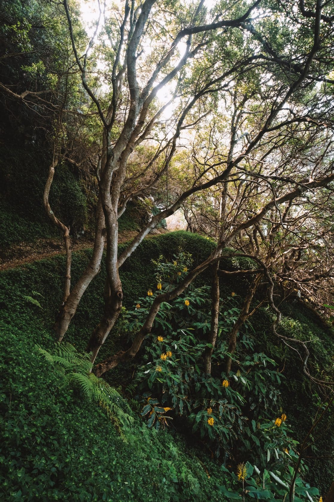
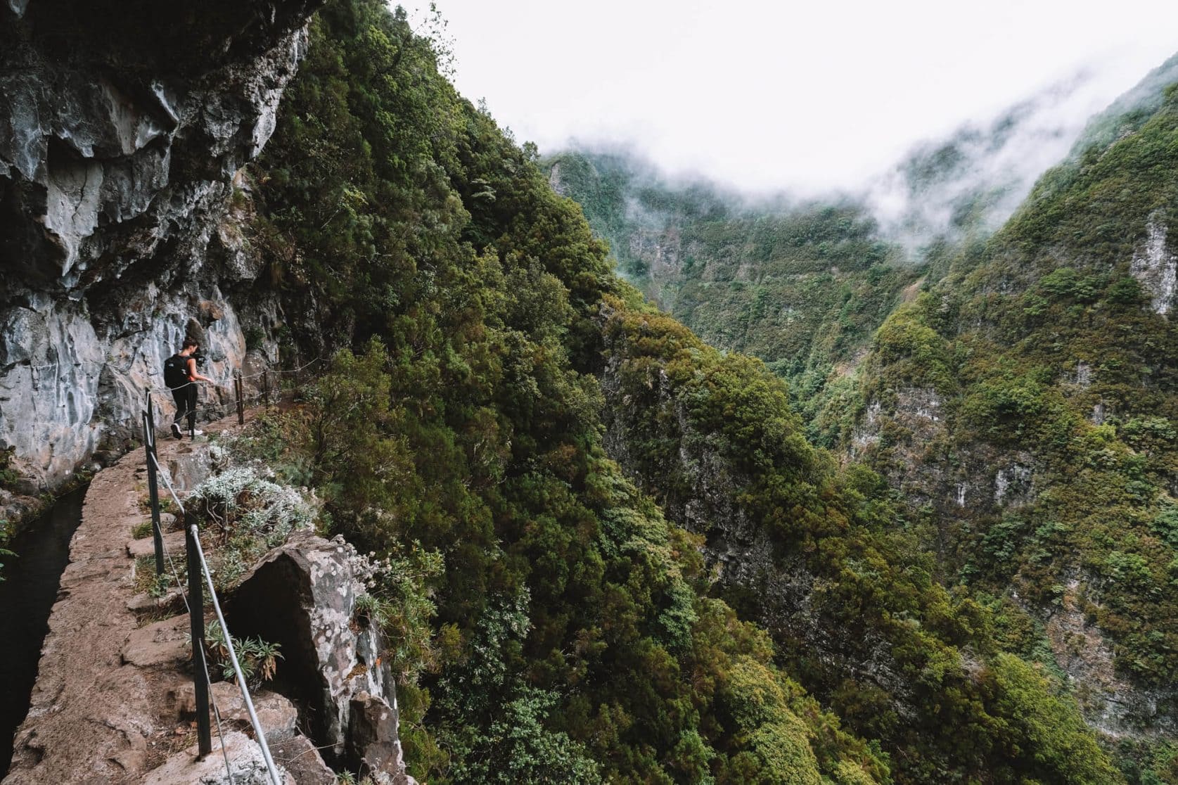
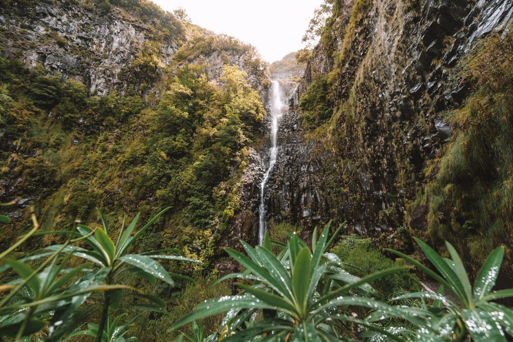
PR9 Levada do Caldeirão Verde Hike
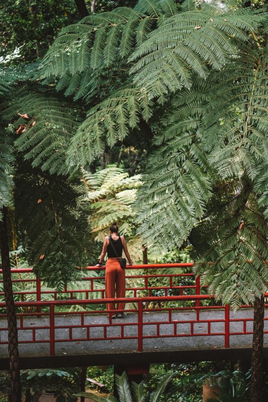
You can’t visit Madeira without having a levada hike on your itinerary, and the PR9 Levada do Caldeirão Verde is one of the most beautiful ones. Not sure what a levada hike is? Please read the section below. This hike is relatively easy but moderately long, taking you through the dense jungle of Madeira, passing through tunnels, and offering breathtaking viewpoints. With good weather, you can gaze down into the gorge hundreds of meters (3280.84 feet) below at certain spots. Thankfully, there are fences along the trail for safety. The levada runs alongside a rock wall that is covered in various types of moss and ferns, creating a vibrant green scenery. After walking approximately 7 kilometers (4.35 miles) on a mostly flat path, you will reach one of the highest waterfalls in Madeira. It’s a delightful spot to rest before starting the return journey.
Read our complete experience and tips for the PR9 to get a better understanding of the hike.
Distance: 13 kilometers (8.08 miles) in total
Duration: 4 to 5 hours
Elevation difference: Approximately 100 meters (328.08 feet)
What is a levada hike? Levada hikes are characteristic of Madeira. A levada is an irrigation channel, and there are over 3,000 kilometers (1864.11 miles) of levadas throughout Madeira. Some were built as early as the 16th century. Levadas wind along the rugged mountains, carrying rainwater from one side of the island to the other, as it rains much more in the north than in the south. These levadas form beautiful walking paths across the mountains.

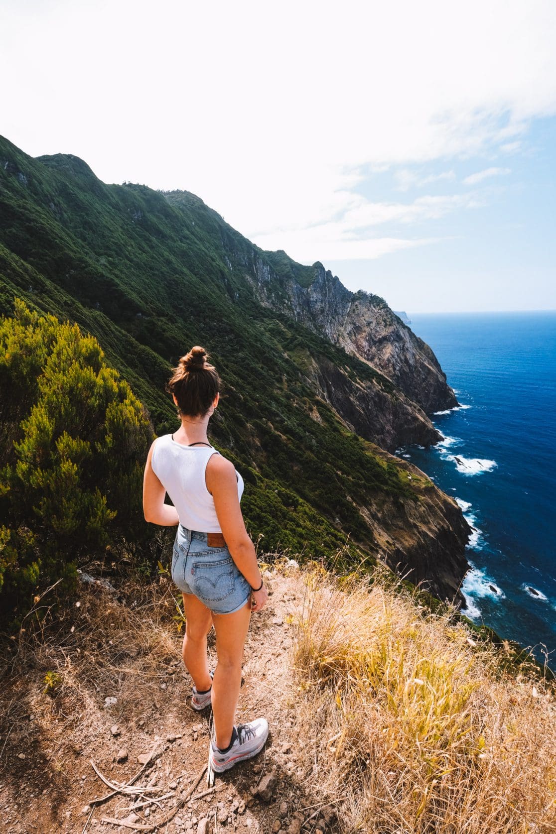
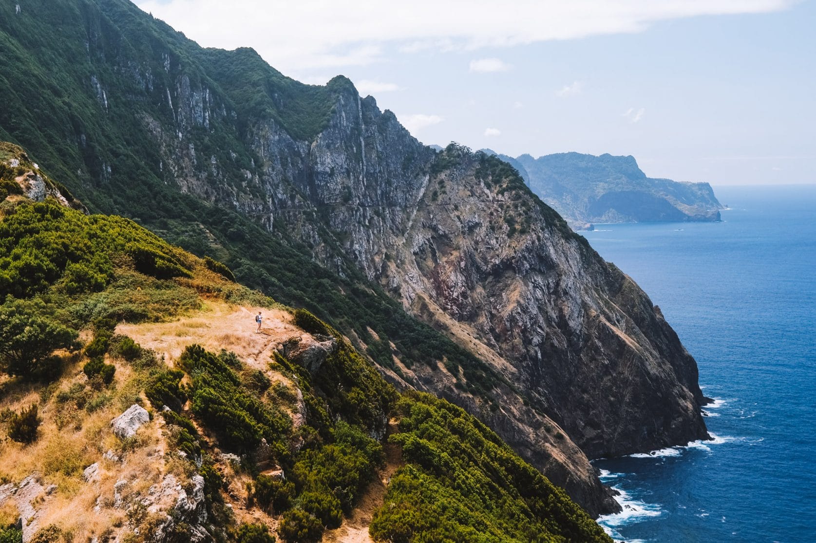
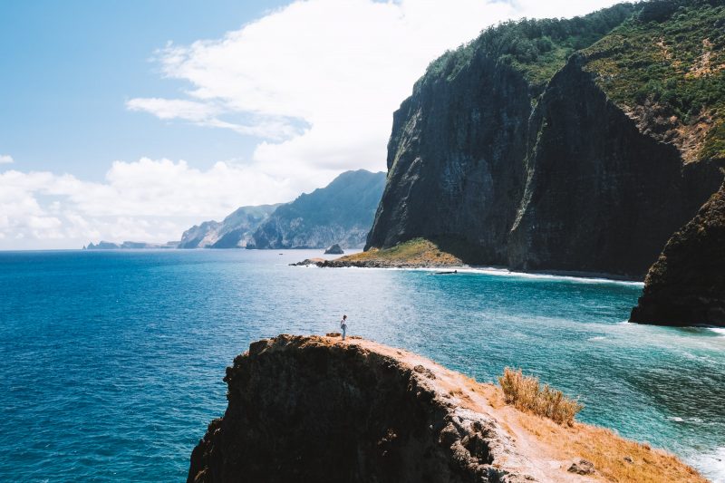
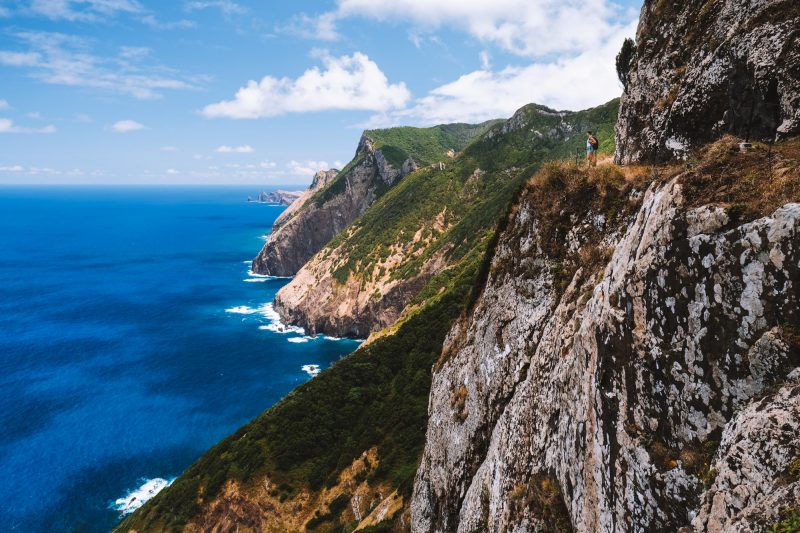
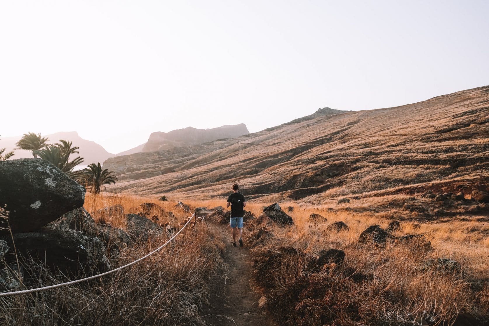
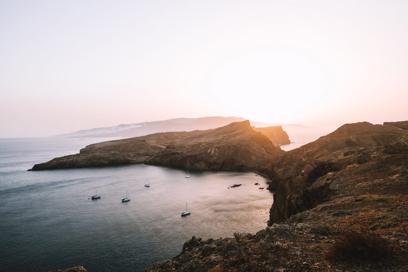
PR8 Ponta de São Lourenço Hike
The PR8 is also a real must-do as it offers the most beautiful cliffs in Madeira. The trail traverses the hills of the narrow peninsula in the east. The hike starts at Ponta de São Lourenço and leads to the viewpoint of Ponta do Furado. From here, you can enjoy views of uninhabited islands and the blue ocean. On clear days, you can even see the neighboring island of Porto Santo. The views along the way are magnificent and completely different from many other places in Madeira. For a large part of the year, this is one of the driest areas on the island, and the vegetation takes on a beautiful golden yellow color.
During winter and spring, the grasses and other small plants turn green, creating a completely different landscape. Although it may seem like not much grows here, there are actually 138 different plant species, 31 of which are unique to Madeira. The trail is very easy to walk and not at all strenuous, except for the final stretch to the viewpoint, which involves a relatively steep climb with some high steps that can be slippery after rain.
Read our complete experience and tips for the PR8 to get a better understanding of the hike.
Distance: 7 km
Duration: 2 to 3 hours
Elevation difference: 470 meters (1541.99 feet)
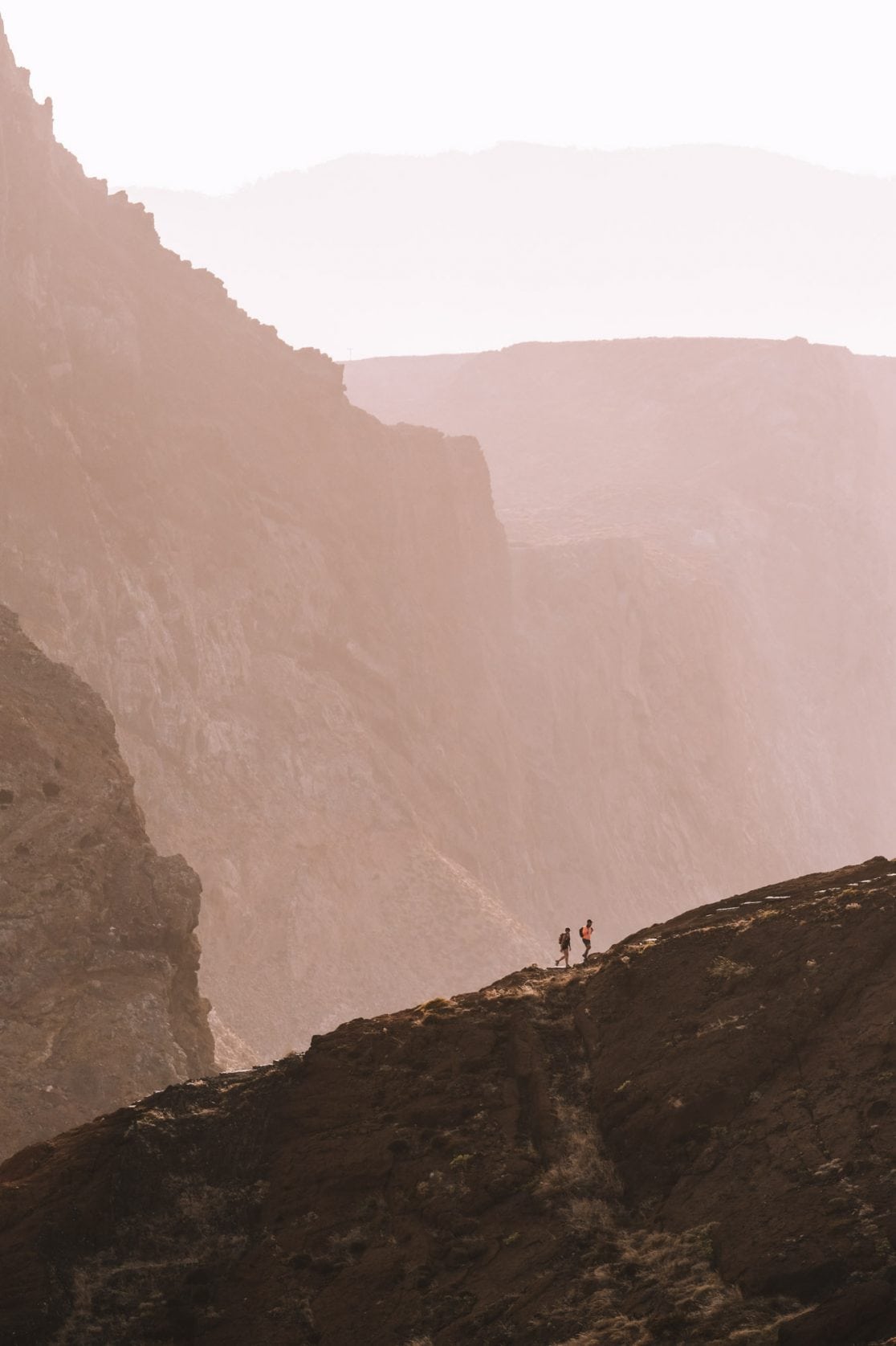


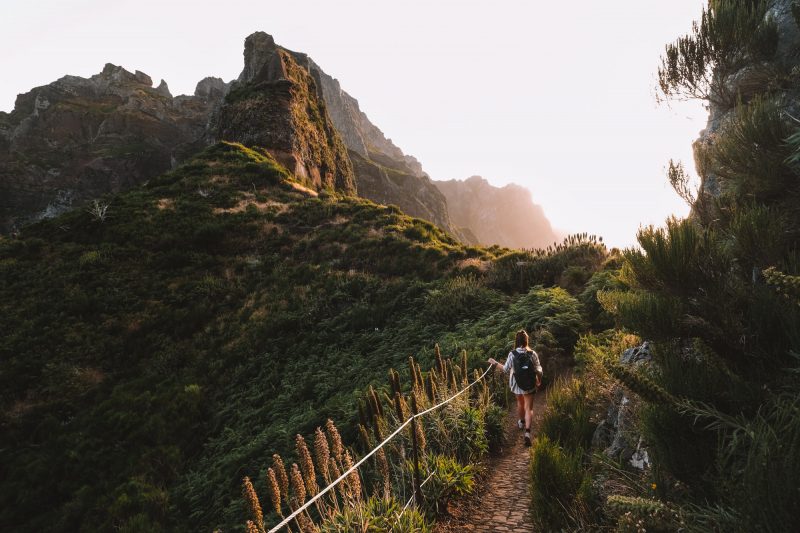
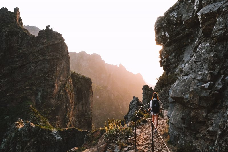
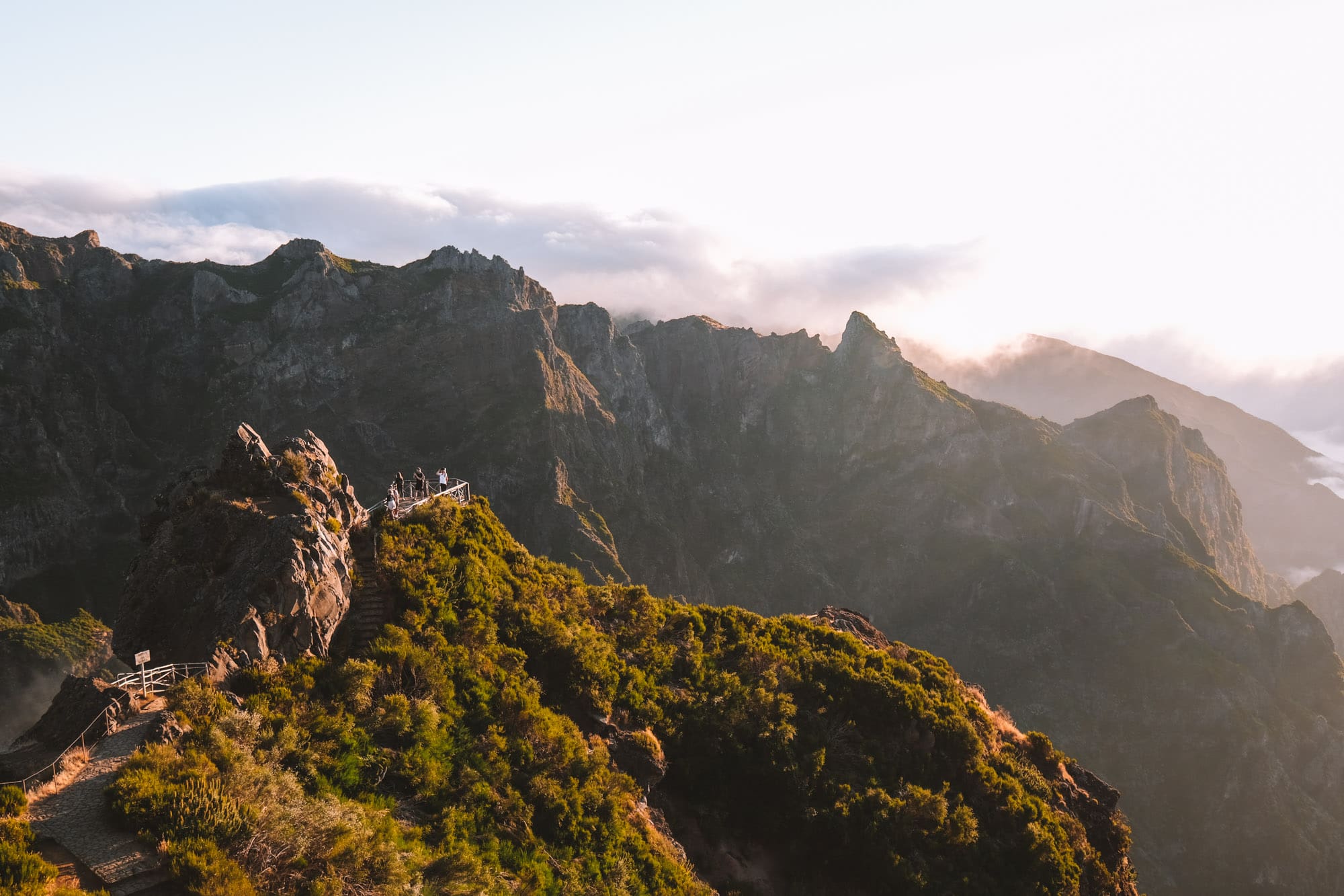
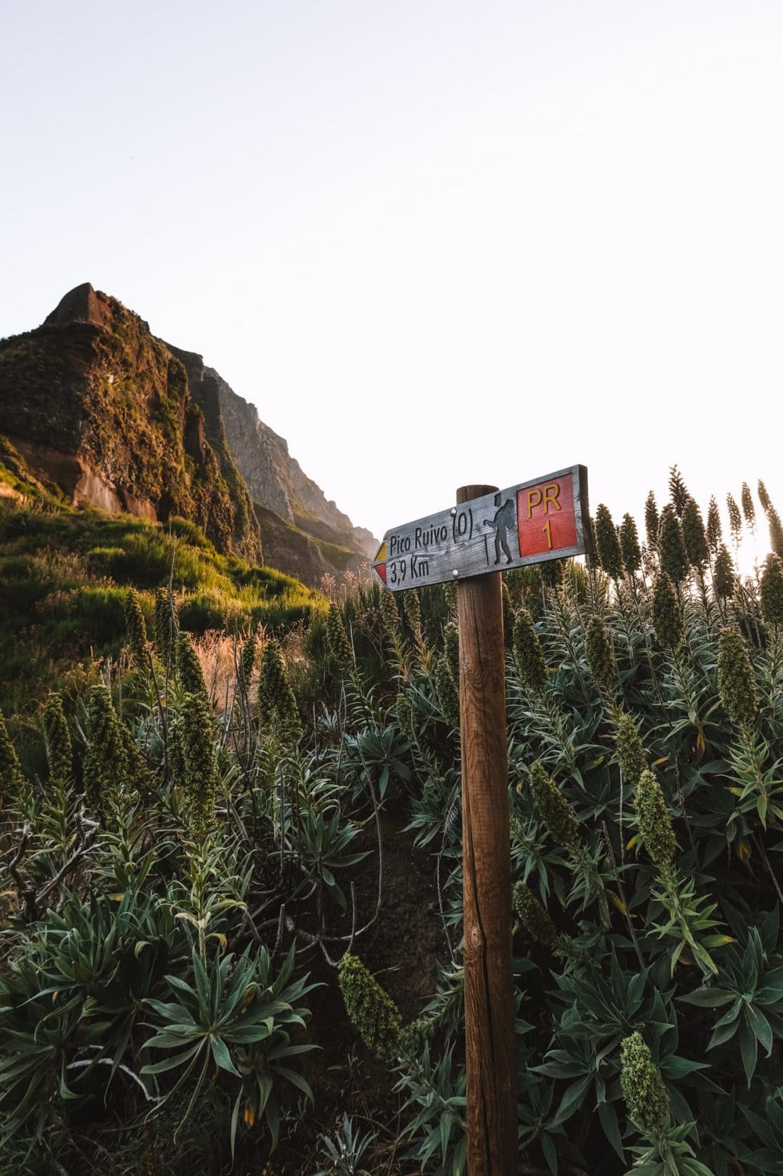
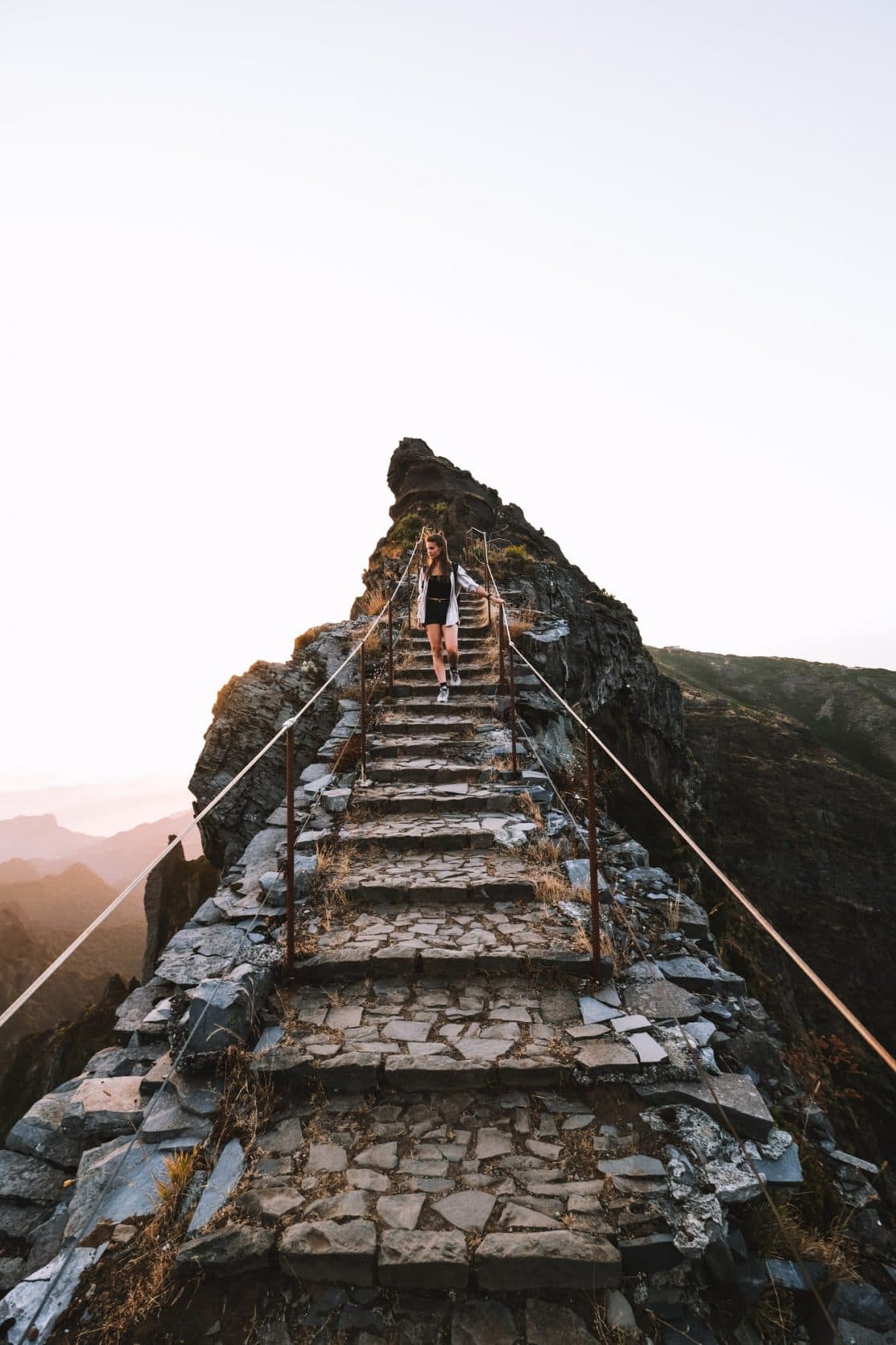
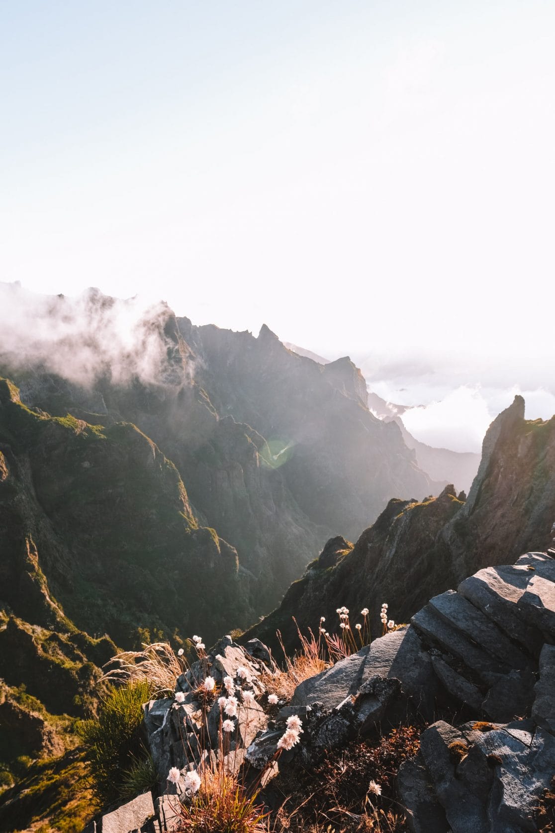
PR1 Vereda do Arieiro Hike
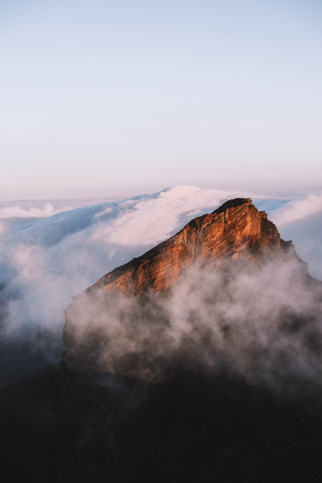
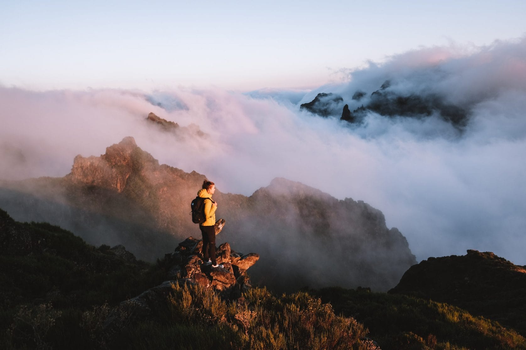
Ready for a challenging workout? The PR1 is our favorite hike in Madeira due to its breathtaking views over the island’s highest peaks. You start at an elevation of 1,818 meters (5,965.88 feet) at Pico do Arieiro and walk from here to the highest mountain on the island, Pico Ruivo, at an elevation of 1,862 meters (6,109.91 feet). The elevation difference between these two giants may not be significant, but to reach there, you’ll have to climb and descend many stair steps. The total elevation difference adds up to around 1,650 meters (5,413.39 feet), making it a quite challenging hike. Fortunately, the views make the effort more than worthwhile.
Start this hike at sunrise because Pico do Arieiro is the best spot to witness the sunrise in Madeira. Often, you’ll find yourself above the clouds, and combined with the 360-degree view and the warm colors of the sunrise, it creates a magical experience. If this hike sounds a bit too strenuous for you, don’t worry, there are also shorter variations of this route available.
Read our complete experience and tips for the PR1 to get a better understanding of the hike.
Distance: 11 km
Duration: 6 hours
Elevation difference: 1650 meters (5413 feet)


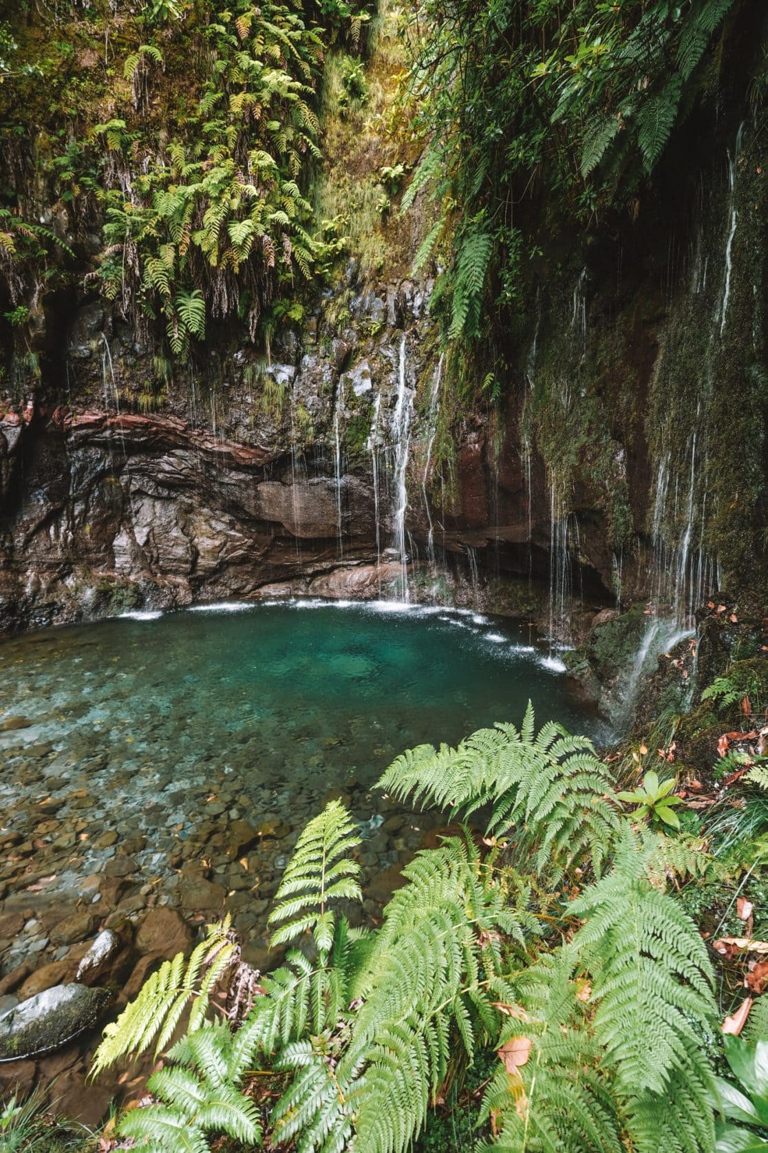
PR6 Levada 25 Fontes & Risco Waterfall Hike
The PR6 and PR6.1 are the most popular levada hikes that you can easily combine. They are highly accessible due to the mostly flat trail and take you to two beautiful waterfalls. One waterfall is several feet high, while the other features 25 separate streams of water flowing into a pool with greenish-blue water. You might even feel like you’re somewhere in Southeast Asia. Since this hike is very popular, it’s recommended to start early to avoid crowds and large groups later in the day.
Read our complete experience and tips for the PR6 + PR6.1 to get a better understanding of the hike.
Distance: Depending on your chosen route
Duration: Depending on your chosen route
Elevation difference: Depending on your chosen route


Boca do Risco Hike
The Boca do Risco hike is a fantastic trail along the high cliffs of Madeira’s coastline. It’s an easy walk on a mostly flat path, with occasional steep drops along the way. The cliff is several hundred feet high and covered with various plant species. The green cliffs create an amazing color combination with the deep blue sea, and the breathtaking views explain why Madeira is sometimes referred to as the “Hawaii of Europe.”
Read our complete experience and tips for the Boca do Risco hike to get a better understanding of the walk.
Distance: 10 km
Duration: 3-4 hours
Elevation difference: 400 meters (1312 feet)